
Water Control Structures
The Ontario Ministry of Natural Resources sponsors the Water and Erosion Control Structure Infrastructure (WECI) program for Conservation Authorities. The program provides support for major maintenance projects and studies important to the viability of flood and erosion control structures. The provincial program requires annual submission of proposals which are reviewed by a committee of peers for project eligibility and ranking.
SNC owns, operates, and maintains seven water control structures and has undertaken four flood control channelization projects throughout the watershed. This infrastructure serves purposes such as flood control, erosion control, low flow augmentation, water supply, recreation, and protection of fish and wildlife habitat.
Learn more about our WECI projects here.
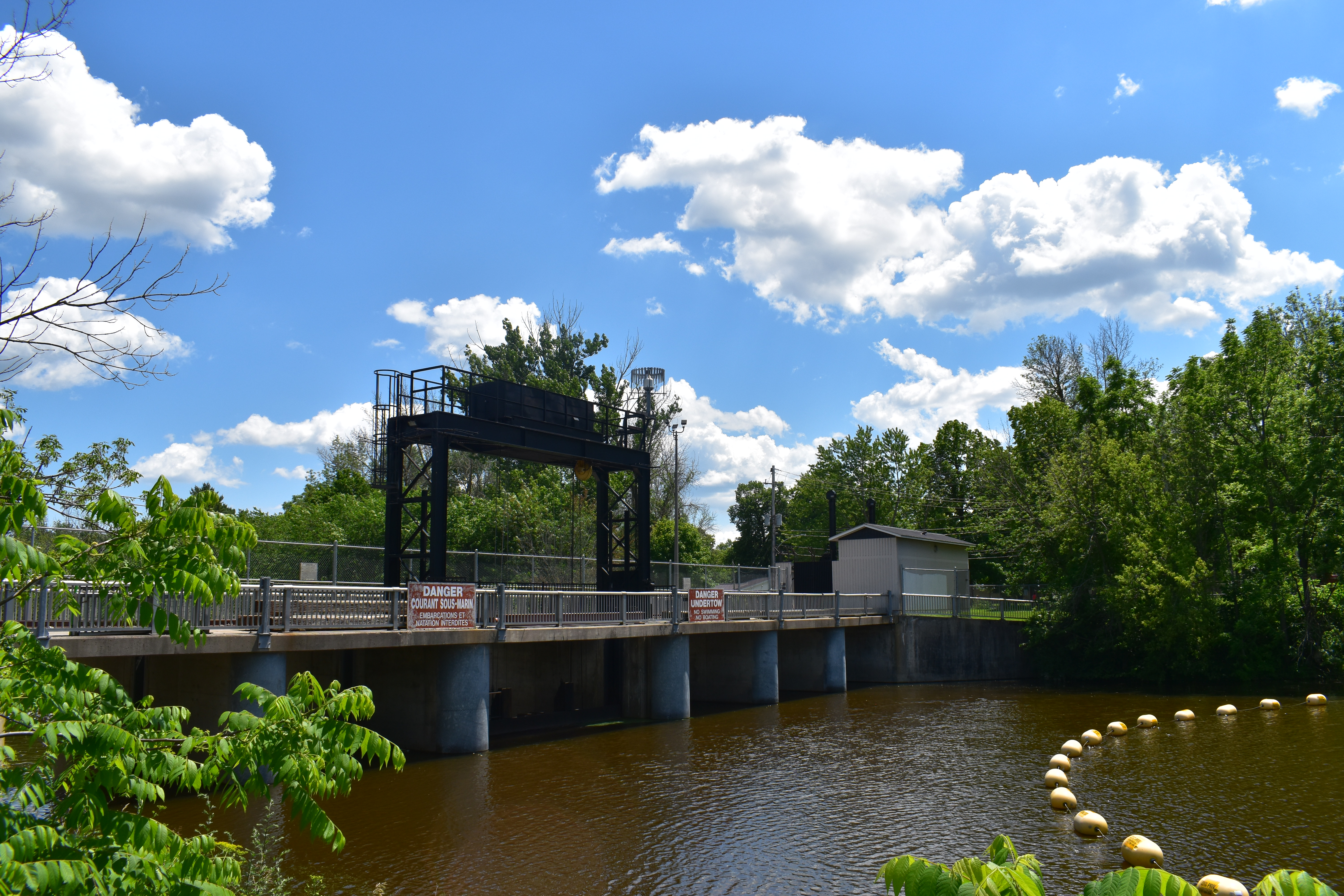
Built: 1978
Location: Chesterville, Ontario, on the South Nation River.
Drainage Area: 1,050 km²
Structure: Six-bay reinforced concrete structure with automatic gate control.
Uses: Previously supplied water to the Nestlé Canada Inc. plant; currently supports flood control.
Safety Features: Operational plans establish seasonal water levels, public awareness materials and require public notification of water
level changes.
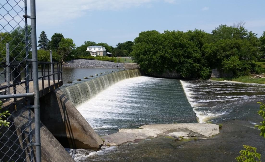
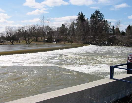
Built: Circa 1900; modified in 1975.
Location: Crysler, Ontario, on the South Nation River.
Drainage Area: 1,300 km²
Structure: Features an overflow section, retaining walls, and a stop log channel. Original intake
channel (now plugged) was used for milling.
Uses: Improves water quality through low-flow augmentation and provides recreational opportunities.
Modifications: Strengthened stone and timber construction, added a downstream concrete apron, and constructed flow channels for
low-flow augmentation.
Built: 1980s in response to a Flood Damage Reduction Study.
Location: Northeast of the Crysler Dam, along the South Nation River.
Structure: Earth berm (420 m long, 3–5 m high) with internal drainage systems, including storm drains with backflow valves, concrete catch basins, culvert pipes, and manholes.
Purpose: Mitigates flood hazards for the Village of Crysler by protecting the southern bank of the South Nation River.
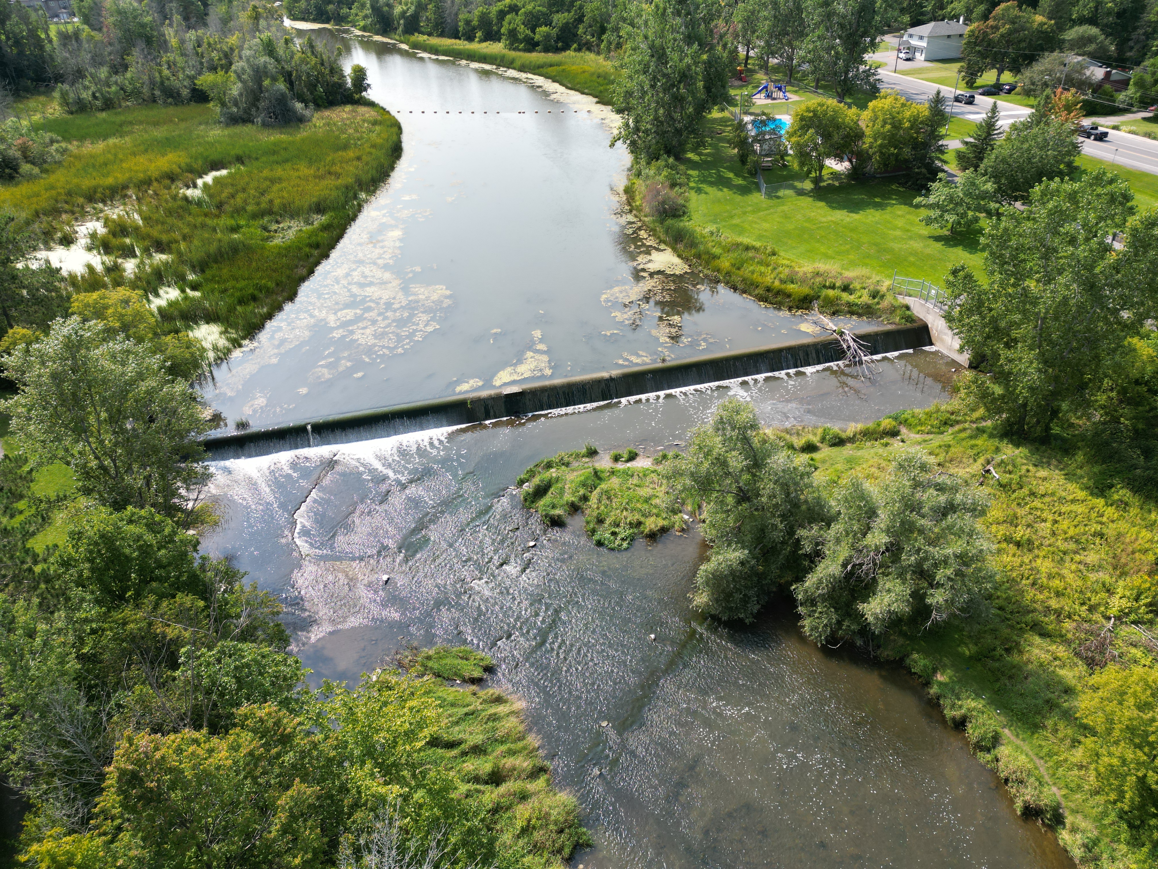
Built: 1958; raised in 1996 by 0.6 m.
Location: Casselman, Ontario, on the South Nation River.
Structure: Overflow section with a one-bay stop log channel.
Uses: Supports recreation, low-flow augmentation, municipal water supply, and hydroelectric generation.
Hydroelectric Plant: A 375 kW facility, constructed in 1987, diverts water upstream of the weir.
Built: 1967 (replacing an unreinforced dam built in 1916 that failed in 1959).
Location: Russell, Ontario, on the Castor River.
Structure: Reinforced concrete weir with a stilling basin (21 m long, 5 m wide, 1.2 m deep) and a non-operational steel sluice gate.
Purpose: Regulates discharge from the Castor River to manage water flow.
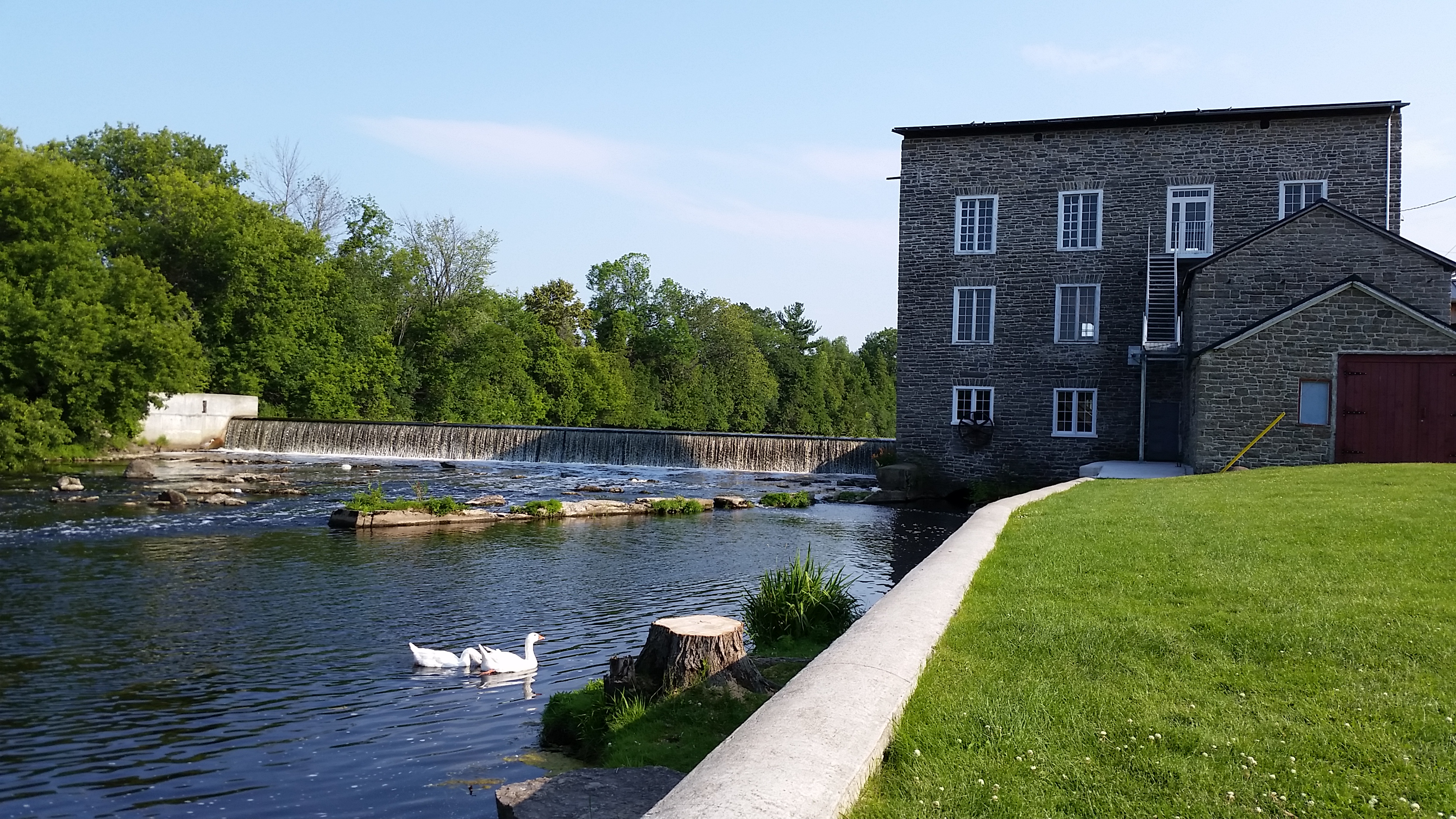
Built: Early 19th century.
Location: Spencerville, Ontario, adjacent to the historic Spencerville Mill on the South Nation River.
Structure: Designed to create a millpond for the Spencerville Mill, with historical community significance.
Uses: Supports recreational activities, such as upstream canoeing, and preserves the milling heritage of the area.
Current Status: Owned and maintained by the Spencerville Mill and Museum Foundation as a heritage feature contributing to recreation and
local history.
Built: 1980 to replace a natural limestone ledge.
Location: Plantagenet, Ontario, on the South Nation River.
Structure: 117.5 m long, 0.6 m thick, and 1.2 m high with galvanized wear plates bolted to angle-iron plates anchored into the concrete crests.
Drainage Area: 3,810 km² with a 10 km impoundment length.
Purpose: Prevents flooding and manages water flow by mitigating spring freshet debris jams.
Built: Between 1987 and 1990 to stabilize riverbanks.
Location: Approximately 2 km north of Casselman, Ontario, along the northeast bank of the South Nation River.
Structure: Rock berm spanning 1,800 m, constructed to prevent toe erosion along the riverbank.
Purpose: Protects more than 50 residential properties in a potential retrogressive landslide area.